Temperature: 35° F
Wind Chill: 25° F
Wind Direction: E at 15 mph. Gusts at 22 mph.
Dew Point: 27° F
Barometric Pressure: 1016.6 mb
Cooler temperatures seems to be the trend so far this week! Once again, the temperatures are hovering just above the freezing mark. The skies have been overcast all day, and I believe this is due to the low pressure system that is moving into the area. Since the wind direction is directly out of the east, I believe that we are right in line with where this system is going to track. Along with it, there will be large amount of precipitation, mainly in the form of snow in the northern parts of Minnesota and Wisconsin.
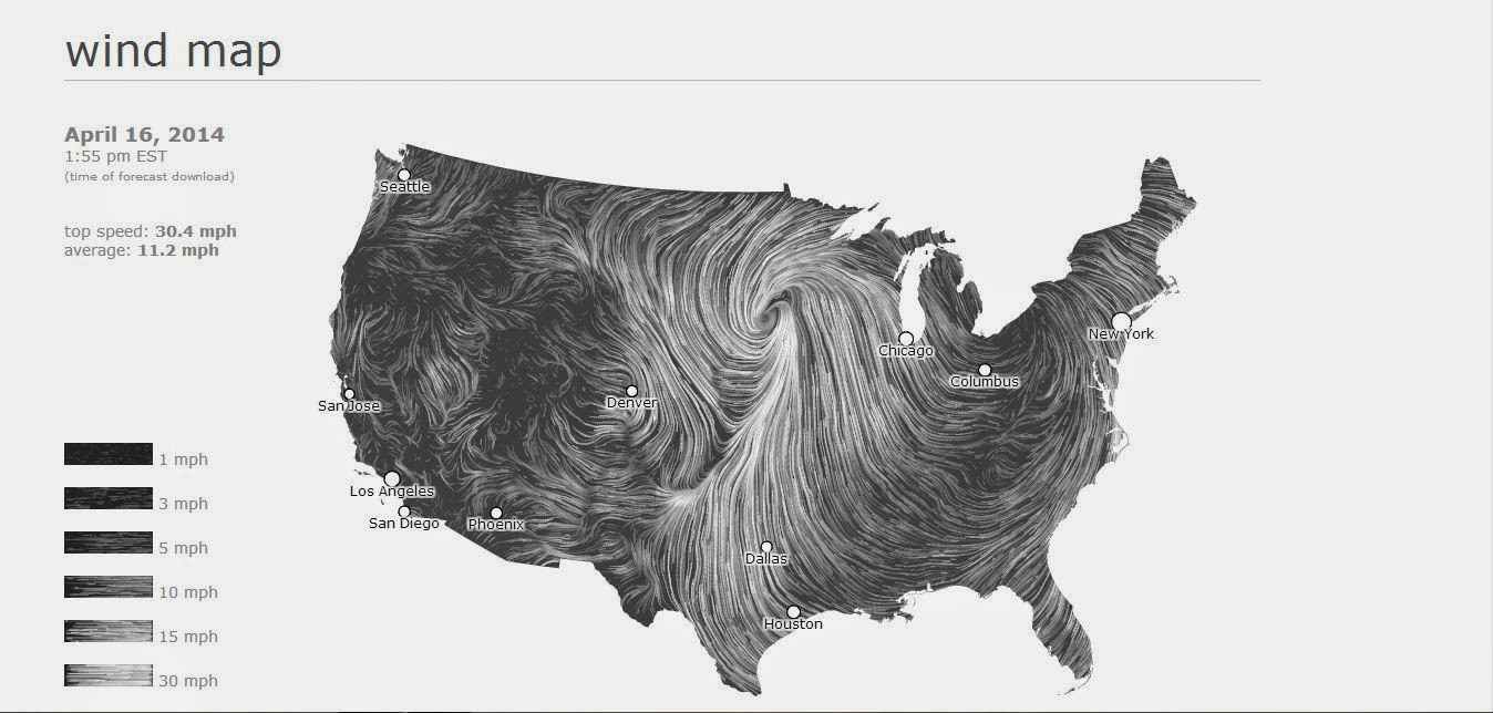
Above is a picture of just how define this system is. It is having an affect on much of the weather in most of the upper Midwest. Below is a picture showing how much water vapor is in the air. There is a large amount of water vapor over much of northern Minnesota and Wisconsin. This will help fuel all the snowfall that is expected in that area.

For tomorrow I believe we will see cloudy conditions yet again. Depending upon how fast the low pressure system moves from the area will determine how fast the skies will clear up. I believe it will be cloudy for most of the day, but may begin to clear up into the late evening hours. Temperatures may begin to warm up slightly due to an approaching warm front from the west.
No comments:
Post a Comment